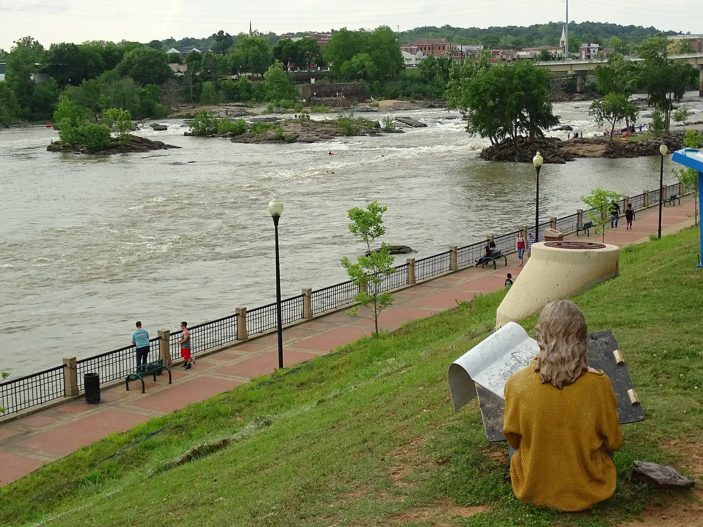
Columbus, Georgia walking and biking trails: the 22-mile RiverWalk, the 10.5-mile Fall Line Trace, Standing Boy Trails and park loops, with access points.
Last checked Oct. 6, 2026. Trail lengths, access points and rules come from the city, the trail operators and Visit Columbus, linked below. Trails can close for high water, storms or construction; check before you go.
Columbus has two long paved trails that meet in Uptown: the Chattahoochee RiverWalk, 22 miles along the river, and the Fall Line Trace, a 10.5-mile rail trail from Psalmond Road. Both belong to the Dragonfly Trails network, which counts 34 miles of connected trails (Dragonfly Trails). For dirt, Standing Boy Trails in north Columbus is the place.
| Trail | Length | Surface | Ends and access |
|---|---|---|---|
| Chattahoochee RiverWalk | 22 miles | Paved | Lake Oliver to the south end near Fort Benning; access at Bay Avenue and 11th Street, among others |
| Fall Line Trace | 10.5 miles | Paved, mostly flat | Psalmond Road to the 14th Street Pedestrian Bridge |
| Standing Boy Trails | Network | Natural surface | North Columbus; parking pass required |
| Oxbow Meadows | Two loops | Walking trails | 3535 S. Lumpkin Road |
Who to call
- City services, park questions: 311
- Ride On Bikes (rentals): 706-324-1132
- Oxbow Meadows: 706-507-8550
- Emergency: 911
Chattahoochee RiverWalk
The city says the RiverWalk began in the late 1980s, opened its first mile in 1992 and now runs 22 miles as an asphalt linear park with restrooms, open to walkers, runners, cyclists and anglers. Its northern section reaches Bibb Mill and Lake Oliver; to the south it passes Golden Park, the Civic Center, Rotary Park, Rigdon Park and Oxbow Meadows on the way toward Fort Benning (city RiverWalk page).
Access points, with parking nearby, according to the city and Visit Columbus:
- Bay Avenue and 11th Street
- Front Avenue and Eighth Street (stairs behind the Space Science Center)
- Front Avenue and Sixth Street (sidewalk)
- Golden Park (stairs and sidewalk)
- Civic Center (stairs)
- Rotary Park, Rigdon Park, 23rd Street, Bibb Mill and Hemlock Park
Rules: no motorized vehicles, no swimming and no alcohol; children 11 and under must be with an adult; pets must be leashed and cleaned up after; fishing is allowed; and pedestrians have the right of way in all cases.
Fall Line Trace
A 12-foot-wide asphalt trail on the old Central of Georgia Railway line, bought by the city from Norfolk Southern and opened in 2011. It runs 10.5 miles from Psalmond Road in northeast Columbus to the 14th Street Pedestrian Bridge in Uptown, where it meets the RiverWalk (Visit Columbus; TrailLink).
- Psalmond Road trailhead: about a dozen parking spaces.
- Flat Rock Park: a fishing spot near the northern end.
- Rest areas: two park-and-ride rest areas, one near Hannan Magnet Academy and one across from Legacy Chevrolet; TrailLink says one large rest area has parking, restrooms and drinking water.
- Columbus State University and MidCity Yards on Fifth Avenue are along the southern half before the trail turns onto 14th Street.
Standing Boy Trails
A nonprofit-run network of hiking, running and mountain bike trails in north Columbus, managed by Standing Boy Inc. Open 5 a.m. to 9 p.m. daily; trails close when very wet. Parking requires a daily or annual pass. Group rides meet in the upper lot at 3 p.m. Sundays and 6 p.m. Thursdays, and trail access opens at 10 a.m. during youth firearm hunts (Visit Columbus listing).
Park trails and loops
- Oxbow Meadows Environmental Learning Center, 3535 S. Lumpkin Road: two walking trails past ponds and wetland, open 9 a.m. to 4 p.m. Tuesday to Saturday (Visit Columbus listing).
- Columbus Botanical Garden, 3603 Weems Road: the Joann Holt Walking Trail, open Tuesday to Sunday, 9 a.m. to 5 p.m. (admission charged) (Visit Columbus listing).
- City parks with trails on the Parks and Recreation map: Britt David Park, Carver Park, Benning Hills Park and Cooper Creek Park (city park map).
Bikes and rentals
Ride On Bikes, on Broadway in Uptown, rents bikes for sightseeing and trail riding and runs group rides, including a full moon ride. Open 11 a.m. to 6:30 p.m. Tuesday to Friday and 11 a.m. to 5 p.m. Saturday, closed Sunday and Monday (Visit Columbus listing).
Frequently asked questions
How long is the Columbus RiverWalk? The city describes the Chattahoochee RiverWalk as a 22-mile paved linear park with restrooms, running from Lake Oliver in the north through Uptown and south toward Fort Benning.
Where does the Fall Line Trace start and end? The paved, mostly flat 10.5-mile rail trail runs from Psalmond Road in northeast Columbus to the 14th Street Pedestrian Bridge and the RiverWalk in Uptown.
Where can I park for the RiverWalk? Visit Columbus says parking is available near each access point, including Bay Avenue and 11th Street, Front Avenue and Eighth Street, Golden Park, the Civic Center, Rotary Park and Rigdon Park.
Is there mountain biking in Columbus, Georgia? Yes. Standing Boy Trails in north Columbus, run by the nonprofit Standing Boy Inc., is open 5 a.m. to 9 p.m. daily for hiking, running and mountain biking. A daily or annual parking pass is required.
Where can I rent a bike in Columbus? Ride On Bikes on Broadway in Uptown rents bikes and is open 11 a.m. to 6:30 p.m. Tuesday to Friday and 11 a.m. to 5 p.m. Saturday.
What this means for you
- Ride the Fall Line Trace into Uptown and loop back on the RiverWalk for a long day out.
- Leash dogs and give pedestrians the right of way on the RiverWalk.
- Check Standing Boy’s status after heavy rain; wet trails close.
Related: dog-friendly Columbus, Uptown Columbus guide and free things to do in Columbus.
Have your say