South Columbus is in ZIP 31903, where Zillow's typical value was $71,776 in August 2026. Most sampled addresses are zoned for Spencer High.
Last checked Oct. 6, 2026. Sources: the city’s 2038 Comprehensive Plan, 2023 update (PDF), the city’s planning area, tax allocation district, points of interest and address point map layers, the Muscogee County School District’s infoFinder zone lookup, the state’s 2025 School Grades data, Zillow Research, METRA and OpenStreetMap.
South Columbus is the area along Victory Drive, Cusseta Road and South Lumpkin Road between the Chattahoochee River and I-185, running south to Fort Benning. The city’s comprehensive plan calls it the Columbus South planning area (Planning Area C), about 6,900 acres, and it holds two of the city’s tax allocation districts.
What this means for you
- Zoned high school: Spencer High (64% of sampled addresses) or Carver High (36%). Check yours with the district’s infoFinder lookup.
- Home value: $71,776 in ZIP 31903 in August 2026, according to the Zillow Home Value Index.
- Nearest interstate exit: I-185 Exit 1, Victory Drive, about 2.2 miles by road.
Part of our Columbus neighborhoods guide.
Where it is
Victory Drive (US 27/280), Cusseta Road, Benning Drive, Fort Benning Road and South Lumpkin Road are the main roads. OpenStreetMap places Benning Hills, Benning Park, Oakland Park, Avondale, Broadmoor, Cusseta Heights, Riverland Terrace and Baker Village here.
The comprehensive plan names these character areas:
- Arbor Point, “the center point of new investment and a complete neighborhood,” around the Arbor Point apartments on Victory Drive, “surrounded by recreational uses, schools, restaurants, general commercial, and access to public transit.” The plan makes the new Spencer High School its northern anchor and wants the Follow Me Trail connected to the RiverWalk.
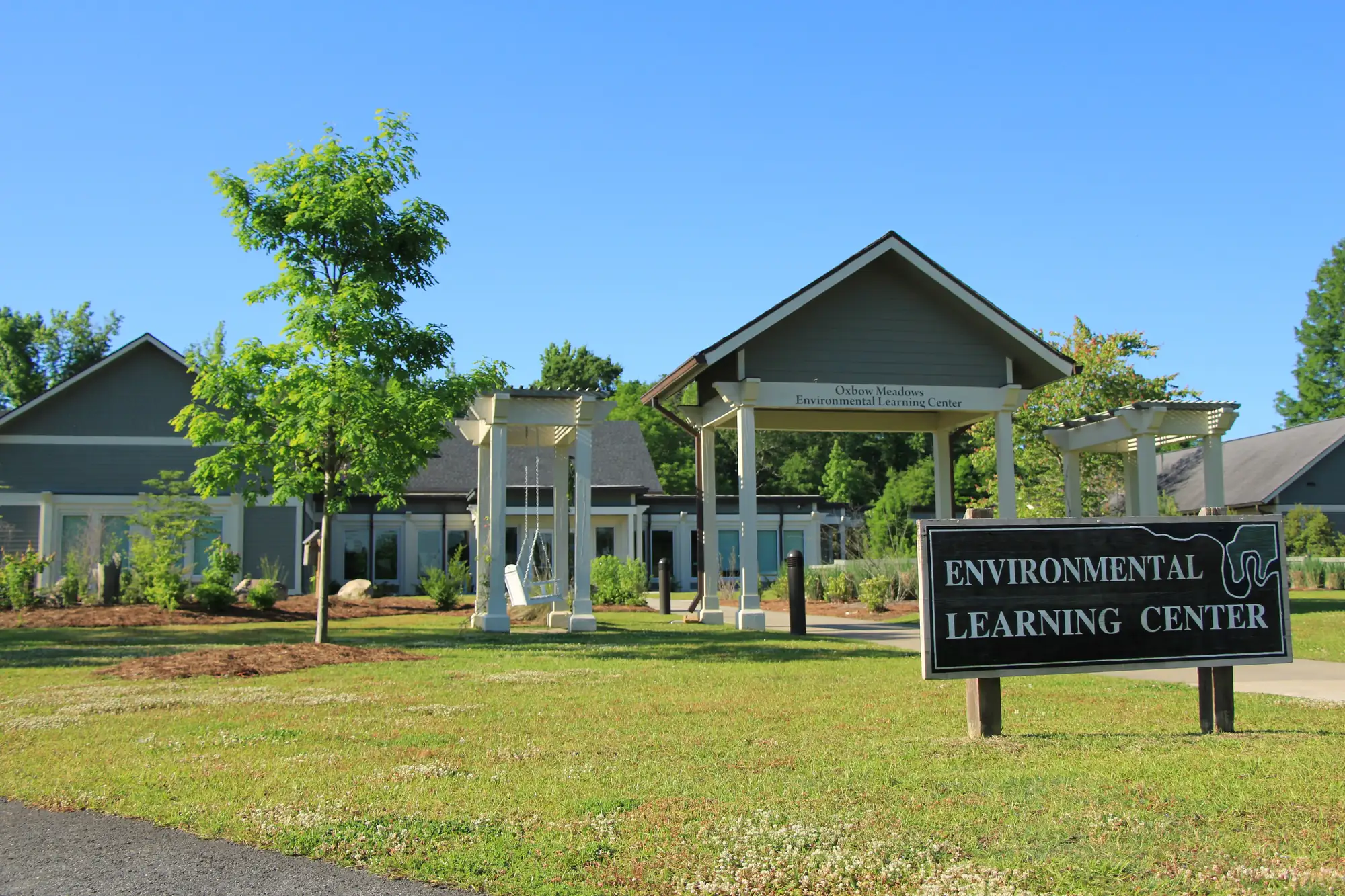
- Oxbow, which the plan calls “a tourist destination adjacent to Fort Benning,” with the National Infantry Museum, Historic Westville, the RiverWalk, Oxbow Meadows Environmental Learning Center, a festival field and a nine-hole golf course.
- Benning Technology Park, the city’s first tax allocation district, created in 2015 for a 183-acre business park between I-185 and Fort Benning. The plan hopes it will draw new homes and shops along Old Cusseta and Farr roads and help revitalize “a much larger area of southeast Columbus.”
The city also has a South Columbus River District tax allocation district here. Its address data has 8,057 address points in the area, 7,229 of them residential, and 99% are in ZIP code 31903.
Schools
How a random sample of 160 residential address points here came back in the district’s infoFinder lookup on Oct. 6, 2026. Scores are 2025 College and Career Ready Performance Index (CCRPI) figures from the state’s School Grades report.
| Level | School | Share of sampled addresses | 2025 CCRPI |
|---|---|---|---|
| High | Spencer High (report card) | 64% | 63.9 |
| High | Carver High (district report card) | 36% | 68.7 |
| Middle | Baker Middle (report card) | 51% | 56.4 |
| Middle | Eddy Middle (report card) | 49% | 47.6 |
| Elementary | Dorothy Height Elementary (report card) | 36% | 45.8 |
| Elementary | Martin Luther King Jr. Elementary (district report card) | 32% | 39.2 |
| Elementary | South Columbus Elementary (report card) | 16% | 64.4 |
| Elementary | Key Elementary (report card) | 14% | 67.0 |
| Elementary | Davis Elementary (district report card) | 6% | 45.6 |
Spencer High, 1000 Fort Benning Road, Baker and Eddy middle schools and four elementary schools are inside the area. The state average was 78.0 and the district scored 69.3. More in our Columbus schools guide.
Home values
The typical home value in ZIP 31903 was $71,776 in August 2026, up 2.82% from $69,805 in August 2025, according to the Zillow Home Value Index. It was the lowest of the ZIP codes Zillow files under Columbus. The index is a modeled typical value for the middle third of homes, not a sale price. The citywide figure was $175,951, up 2.92%. More in our home prices guide.
Parks and trails
From the city’s points of interest data and its parks pages:
- Oxbow Meadows, 3535 S. Lumpkin Road, with the environmental learning center and a RiverWalk access point.
- Rigdon Park, 1600 Howe Ave., a RiverWalk access point.
- Benning Park and the Frank Chester Recreation Center, 1441 Benning Drive.
- Benning Hills Park, 101 Patton Drive.
- South Columbus Library, 2034 S. Lumpkin Road.
- Chattahoochee RiverWalk: runs along the river through the area south toward Fort Benning.
More in our parks and trails guide.
Getting around
- Interstate: I-185 Exit 1, Victory Drive, about 2.2 miles by road; Exit 4, Buena Vista Road, about 3.7 miles.
- Government Center, 100 10th St.: about 4.1 miles.
- Columbus Airport: about 8.4 miles. Hartsfield-Jackson Atlanta International Airport: about 103.6 miles.
- Distances are measured on the OpenStreetMap road network with the OSRM routing engine from 3444 Victory Drive, an address near the middle of the area. They are distances, not drive times.
- Bus: in the city’s METRA stop data, most stops here are on Route 4, Fort Benning and Route 2, Cusseta Road/Oakland Park, with more on Route 7, Columbus South.
More in our getting around guide.
Groceries and everyday stores
From OpenStreetMap:
- Walmart Supercenter, with pharmacy, 3515 Victory Drive
OpenStreetMap also places a CVS Pharmacy near Victory Drive and Levy Road.
How we drew this area
This area is the comprehensive plan’s Columbus South planning area, taken from the Columbus Consolidated Government’s planning area map layer. Address counts and ZIP codes come from the city’s address point layer. School shares come from 160 randomly chosen residential address points checked against the district’s infoFinder lookup on Oct. 6, 2026. Store locations are © OpenStreetMap contributors.
Frequently asked questions
Is South Columbus a good place to live?
Here are the facts. South Columbus runs along Victory Drive between the river and I-185, next to Fort Benning, with Oxbow Meadows, Rigdon Park and the south end of the RiverWalk. In a sample of addresses, 64% were zoned for Spencer High, which scored 63.9 on Georgia’s 2025 CCRPI, and Zillow put the typical value in ZIP 31903 at $71,776 in August 2026.
What high school is South Columbus zoned for?
Spencer High or Carver High. In the district’s lookup, 64% of sampled South Columbus addresses were zoned for Spencer and 36% for Carver.
What ZIP code is South Columbus?
- About 99% of residential addresses in the city’s Columbus South planning area are in ZIP code 31903.
What is Arbor Point in Columbus?
The city’s comprehensive plan names Arbor Point a character area on Victory Drive, centered on the Arbor Point apartments and anchored on the north by the new Spencer High School, with recreation, schools, shops and transit around it.
Have your say