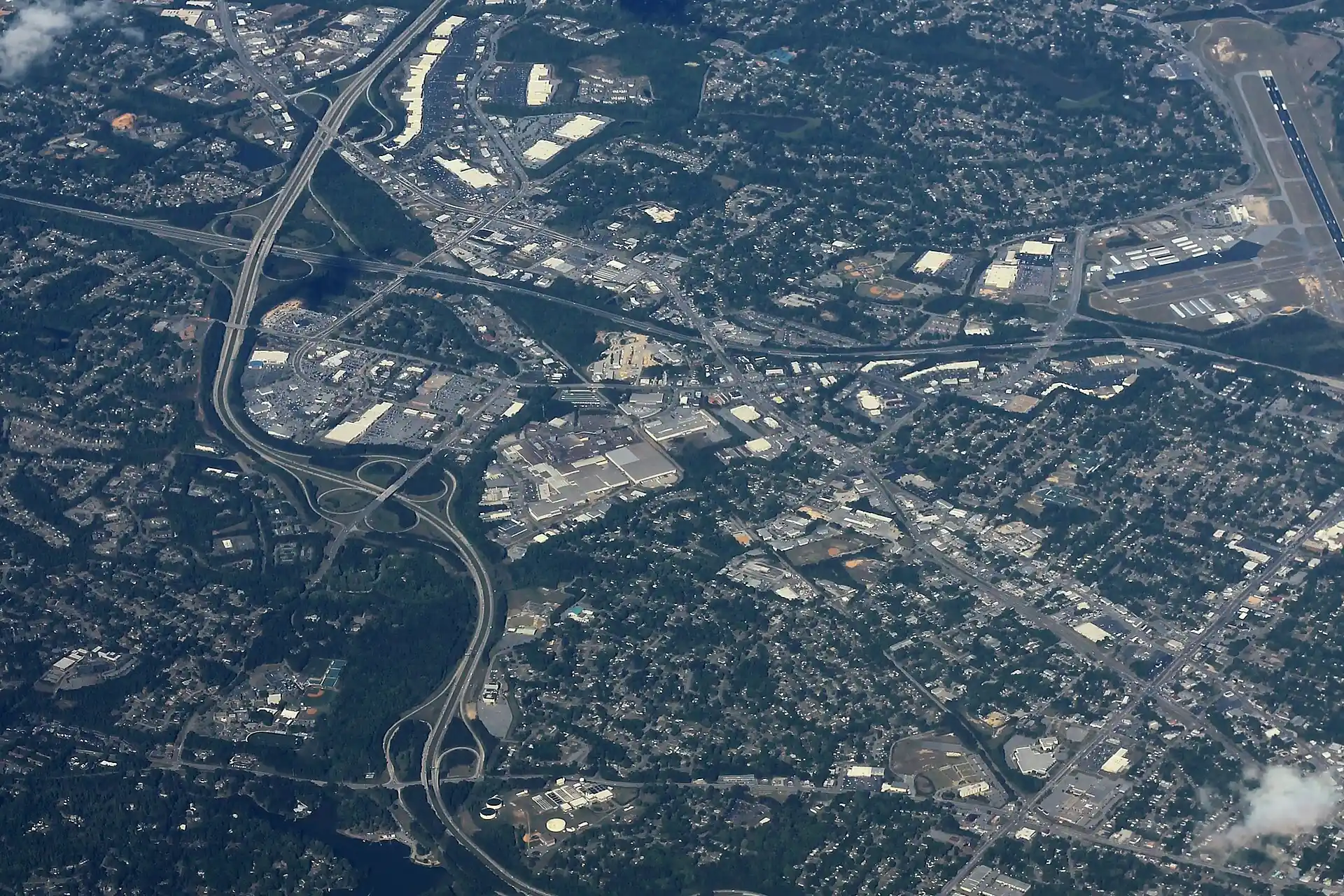
Columbus in eight areas, from Uptown to Midland: ZIP codes, zoned high schools and Zillow home values ($71,776 to $387,181 by ZIP in August 2026).
Last checked Oct. 6, 2026. Sources: the city’s 2038 Comprehensive Plan, 2023 update (PDF) and its planning area, historic district, tax allocation district and address point map layers; the Muscogee County School District’s infoFinder zone lookup; the state’s 2025 School Grades data; Zillow Research; the Census Bureau’s American Community Survey; and OpenStreetMap.
Columbus and Muscogee County are one consolidated government, so the city limits are the county line on three sides and the Chattahoochee River, and the Alabama line, on the west. Fort Benning fills the south. I-185 runs north and south through the middle, and J.R. Allen Parkway (US 80) crosses the north side from Phenix City toward Midland. The Census Bureau’s 2020-2024 estimates put the population at 203,711, with a median household income of $58,073 and a median owner-reported home value of $193,900, according to the American Community Survey.
What this means for you
- Schools: one district, the Muscogee County School District, serves the whole city, but its zones do not follow neighborhood or ZIP code lines. Check every address with the infoFinder lookup before you sign.
- ZIP codes: Columbus mail goes to 31901, 31903, 31904, 31906, 31907 and 31909; Midland (31820) and Upatoi (31829) are inside the consolidated city with their own postal names.
- Taxes: one bill carries the city-county rate and the school rate; the city rate varies by urban service district. See our property tax guide.
The areas at a glance
The city’s comprehensive plan divides Columbus into six planning areas. We use them, and split the plan’s Midtown/Uptown area into three, using the city’s own tax allocation district, historic district and Liberty District boundaries. The ZIP code is the one most of the area’s addresses use; the high school is the one most sampled addresses are zoned for; the value is Zillow’s typical home value for that ZIP code in August 2026.
| Area | Main ZIP | Main zoned high school | Typical value in that ZIP | Guide |
|---|---|---|---|---|
| Uptown and the Historic District | 31901 | Jordan Vocational | $160,215 | Uptown and the Historic District |
| Liberty District | 31901 | Jordan Vocational | $160,215 | Liberty District |
| Midtown | 31906 | Jordan Vocational, Carver or Hardaway | $132,375 | Midtown |
| Bibb City, Beallwood and North Highlands | 31904 | Jordan Vocational | $220,602 | Bibb City |
| Northwest Columbus | 31909 | Northside | $235,770 | Northwest Columbus |
| Midland and the Panhandle | 31820 | Shaw | $387,181 | Midland |
| Southeast Columbus | 31907 | Kendrick | $162,219 | Southeast Columbus |
| South Columbus | 31903 | Spencer | $71,776 | South Columbus |
The Zillow Home Value Index is a modeled typical value for the middle third of homes, not a sale price. The citywide figure was $175,951 in August 2026, up 2.92% in a year. Each ZIP code mixes very different streets; see each area’s page and our home prices guide.
Map
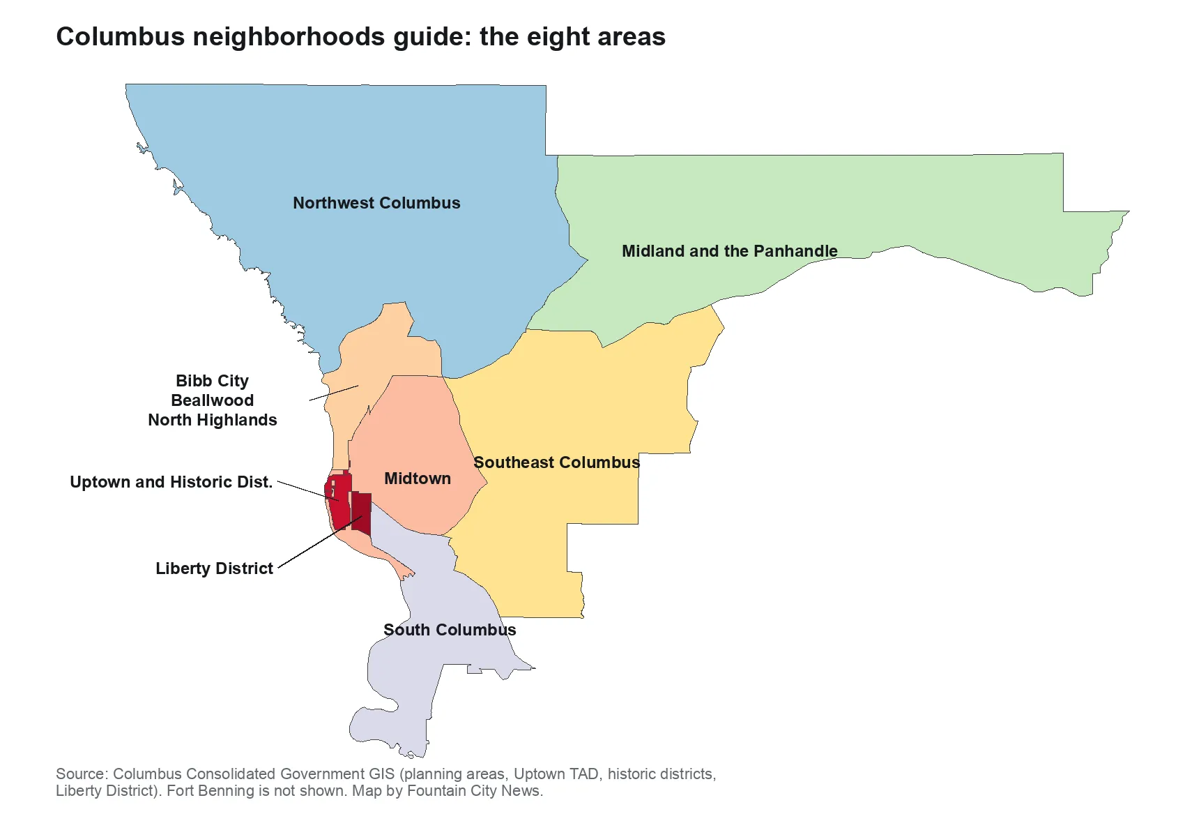
Map by Fountain City News from Columbus Consolidated Government GIS layers.
Uptown and the Historic District
The central business district on the river and the residential grid at its southern end, all in ZIP 31901. Every sampled address was zoned for Jordan Vocational High. Exterior changes in the Downtown and High Uptown historic districts need city approval. Read the Uptown and Historic District guide.
Liberty District
The small neighborhood around the Liberty Theatre, east of Veterans Parkway, with the Ma Rainey House and the Mildred Terry Library. The plan marks many city-owned lots here for redevelopment. Read the Liberty District guide.
Midtown
The older neighborhoods between Uptown and I-185, including Wynnton, Dinglewood and the streets around Lakebottom Park, with seven local historic districts and the first miles of the Fall Line Trace. High school zones split three ways. Read the Midtown guide.
Bibb City, Beallwood and North Highlands
The old mill districts on the river north of Uptown. Bibb City, a former company town, joined the consolidated government in 2000 and is on the National Register of Historic Places. Read the Bibb City guide.
Northwest Columbus
The largest planning area, with Columbus Park Crossing, Old Town, Lake Oliver and Columbus Airport. About half of sampled addresses were zoned for Northside High. Read the Northwest Columbus guide.
Midland and the Panhandle
The long eastern arm of the city along J.R. Allen Parkway, with Midland, Upatoi, Beaver Run and Flat Rock Park. Nearly every sampled address was zoned for Shaw High, and the city’s METRA stop data shows no regular bus stops here. Read the Midland guide.
Southeast Columbus
The area east of I-185 with the most homes in the city’s address data, including Columbus State University and Cooper Creek Park. About half of sampled addresses were zoned for Kendrick High. Read the Southeast Columbus guide.
South Columbus
The Victory Drive corridor between the river and I-185, next to Fort Benning, with Oxbow Meadows, Arbor Point and the new Spencer High School. Read the South Columbus guide.
Comparing Columbus with its neighbors
Taxes, schools and home values in Columbus, Phenix City, Cusseta and Smiths Station are side by side in our Columbus vs. Phenix City vs. Cusseta vs. Smiths Station guide. See also moving to Columbus, getting around and Columbus schools.
How we built this
- Areas: the six planning areas in the city’s 2038 Comprehensive Plan, from the Columbus Consolidated Government’s planning area map layer. We split the Midtown/Uptown area using the city’s Uptown tax allocation district, its Downtown and High Uptown historic districts and its Liberty District layer. Place names inside each area come from the plan’s character areas and from OpenStreetMap. We name no subdivision the city or OpenStreetMap does not name as a place.
- Addresses and ZIP codes: the city’s address point layer, 85,023 points.
- Schools: 100 to 160 randomly chosen residential address points per area, checked against the district’s infoFinder lookup on Oct. 6, 2026, with 2025 CCRPI scores from the Governor’s Office of Student Achievement.
- Distances: measured on the OpenStreetMap road network with the OSRM routing engine; they are distances, not drive times.
- Map data: © OpenStreetMap contributors and Columbus Consolidated Government GIS.
Frequently asked questions
What are the main areas of Columbus, Georgia?
The city’s comprehensive plan divides Columbus into six planning areas: Northwest Columbus, the Panhandle (with Midland and Upatoi), Bibb City/Beallwood/North Columbus, Midtown/Uptown, Columbus South and Southeast Columbus. Our guide splits Midtown/Uptown into Uptown and the Historic District, the Liberty District and Midtown.
Which part of Columbus has the highest home values?
By Zillow’s index for August 2026, the Midland ZIP code 31820 ($387,181) and Upatoi’s 31829 ($387,039), both in the Panhandle, were highest, followed by 31909 ($235,770) in the north. ZIP 31903 in South Columbus was lowest at $71,776.
What school district serves Columbus, Georgia?
The Muscogee County School District serves all of Columbus and Muscogee County. Zones do not follow neighborhood lines, so check an address with the district’s infoFinder lookup or call 706-748-2000.
Are Midland and Upatoi part of Columbus?
Yes. Both are inside the consolidated city of Columbus and Muscogee County, in the Panhandle planning area. They keep their own postal names and ZIP codes, 31820 and 31829.
How many people live in Columbus, Georgia?
203,711, according to the Census Bureau’s American Community Survey 2020-2024 five-year estimates, with a median household income of $58,073.
Have your say