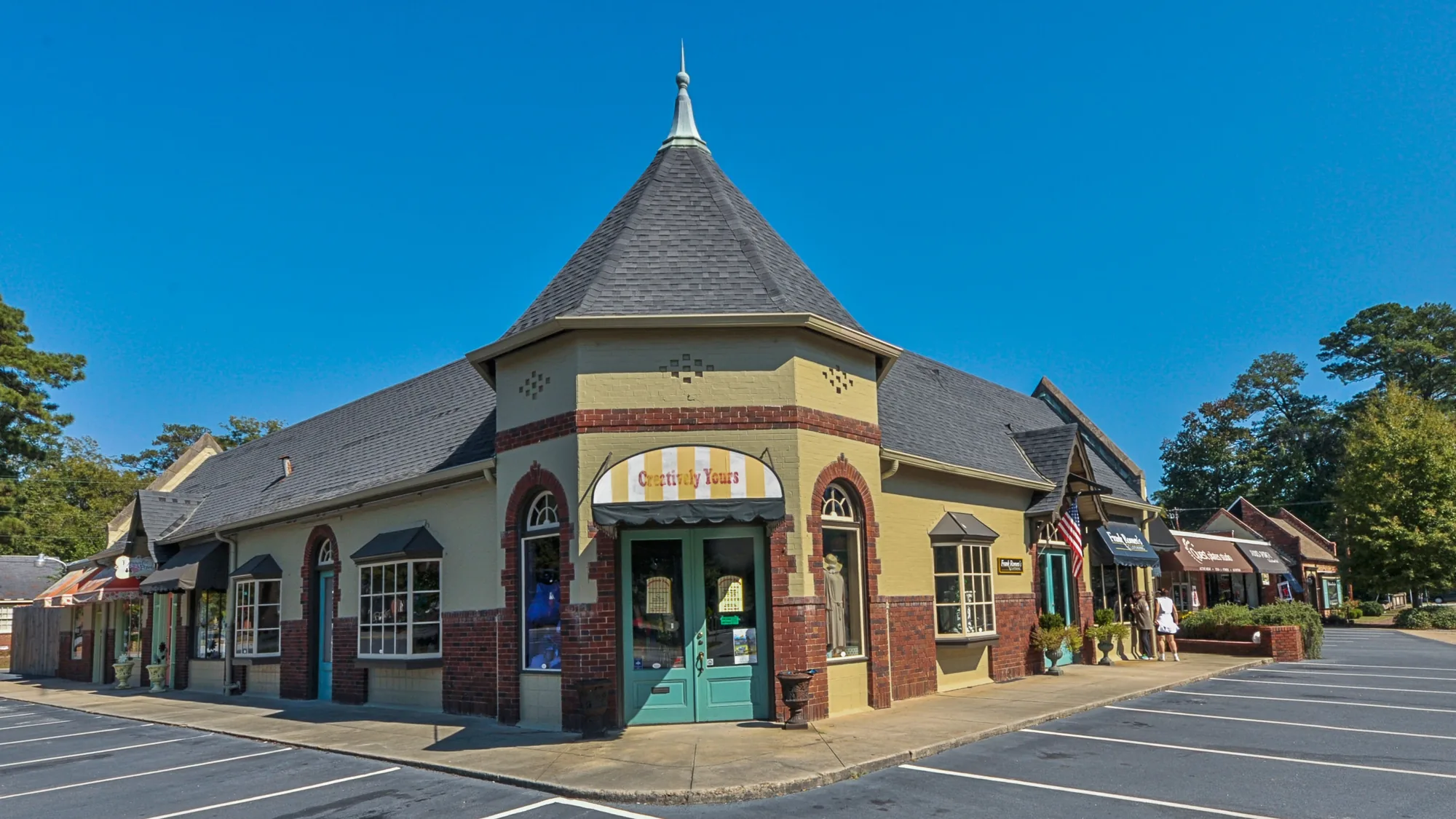
Midtown Columbus spans ZIPs 31906, 31904 and 31901 and seven historic districts. Zillow's typical 31906 value: $132,375 in August 2026.
Last checked Oct. 6, 2026. Sources: the city’s 2038 Comprehensive Plan, 2023 update (PDF), the city’s planning area, historic district, points of interest and address point map layers, the Muscogee County School District’s infoFinder zone lookup, the state’s 2025 School Grades data, Zillow Research, METRA and OpenStreetMap.
Midtown is the band of older neighborhoods between Uptown and I-185: Wynnton, the streets around Lakebottom Park, the medical district and the city’s Civic Commons on Macon Road. It is the largest share of the comprehensive plan’s Midtown/Uptown planning area, and the city has two tax allocation districts here, MidTown West and MidTown East, created in 2016 to fund infill building and repairs.
What this means for you
- Zoned high school: split three ways: Jordan Vocational High (47% of sampled addresses), Carver High (29%) and Hardaway High (24%). Check yours with the district’s infoFinder lookup.
- Home value: $132,375 in ZIP 31906 and $220,602 in ZIP 31904 in August 2026, according to the Zillow Home Value Index.
- Nearest interstate exit: I-185 Exit 6, Macon Road, about 1.5 miles by road.
Part of our Columbus neighborhoods guide.
Where it is
Midtown here is the city’s Midtown/Uptown planning area (Planning Area D) without Uptown, the Historic District and the Liberty District, which have their own pages. It runs east from Veterans Parkway toward I-185, and from Victory Drive and South Commons in the south to the Hamilton Road area in the north. Macon Road, Wynnton Road, Talbotton Road, Warm Springs Road and Manchester Expressway are the main roads.
OpenStreetMap names places here including Wynnton, Dinglewood, Weracoba Heights, Rose Hill, East Highlands, Carver Heights and Clubview Heights. The comprehensive plan marks several smaller character areas in and around it:
- The Medical Corridor, the link between St. Francis Hospital and Piedmont Columbus Regional along Woodruff Road and Talbotton and Warm Springs roads.
- Five Points, at 17th Street and 13th Avenue, “strategically located between Lakebottom Park and downtown Columbus,” which the plan wants master-planned for mixed use.
- 13th and 13th, between Midtown and Uptown, where 13th Street is approved for a road diet.
- Civic Commons, the former grayfield on Macon Road now home to the Citizen Service Center, the school district’s main office, the main library, Rainey-McCullers School of the Arts, Rigdon Road Elementary and the Columbus Aquatic Center.
The city’s address data has 14,425 address points here, 12,691 of them residential. By ZIP code, 54% are in 31906, 27% in 31904 and 19% in 31901.
Homes and historic districts
The plan’s MidTown redevelopment section calls for “rehabilitating existing housing and creating new residential living options” around older commercial nodes, and for public money toward “inadequate water and sewer infrastructure” serving established neighborhoods.
The city’s historic district map places seven local historic districts in Midtown: Wynnton Village, Weracoba-St. Elmo, Dinglewood, Peacock Woods-Dimon Circle, Wildwood Circle, Wynn’s Hill-Overlook and Waverly Terrace. In those districts, exterior changes need a Certificate of Appropriateness from the Board of Historic and Architectural Review, 706-225-3941.
Schools
How a random sample of 160 residential address points here came back in the district’s infoFinder lookup on Oct. 6, 2026. Scores are 2025 College and Career Ready Performance Index (CCRPI) figures from the state’s School Grades report.
| Level | School | Share of sampled addresses | 2025 CCRPI |
|---|---|---|---|
| High | Jordan Vocational High (report card) | 47% | 63.0 |
| High | Carver High (district report card) | 29% | 68.7 |
| High | Hardaway High (report card) | 24% | 64.0 |
| Middle | Richards Middle (district report card) | 43% | 84.7 |
| Middle | Arnold Middle (report card) | 20% | 68.2 |
| Middle | Rothschild Leadership Academy (report card) | 16% | 57.0 |
| Middle | Baker Middle (report card) | 14% | 56.4 |
| Elementary | Wynnton Elementary (report card) | 19% | 59.6 |
| Elementary | Rigdon Road Elementary (report card) | 18% | 54.7 |
| Elementary | Johnson Elementary (report card) | 15% | 50.3 |
| Elementary | Hannan Elementary (report card) | 15% | 67.5 |
| Elementary | Davis Elementary (district report card) | 13% | 45.6 |
| Elementary | Clubview Elementary (report card) | 11% | 74.7 |
| Elementary | Dorothy Height Elementary (report card) | 9% | 45.8 |
A few sampled addresses were zoned for Double Churches Middle, Eddy Middle or Downtown Elementary Magnet Academy. Two magnet schools sit inside Midtown: Columbus High, 1700 Cherokee Ave., which scored 99.7, and Rainey-McCullers School of the Arts, 1700 Midtown Drive, which scored 88.8. The state average was 78.0 and the district scored 69.3. More in our Columbus schools guide.
Home values
From the Zillow Home Value Index for August 2026:
| ZIP code | Share of Midtown addresses | Typical value | Change in a year |
|---|---|---|---|
| 31906 | 54% | $132,375 | -0.35% |
| 31904 | 27% | $220,602 | +3.96% |
| 31901 | 19% | $160,215 | +1.08% |
The index is a modeled typical value for the middle third of homes, not a sale price. Each ZIP code reaches well beyond Midtown, so these are broad guides. The citywide figure was $175,951, up 2.92% on the year. More in our home prices guide.
Parks and trails
From the city’s points of interest data and its parks pages:
- Lakebottom Park, 1505 Cherokee Ave.
- Dinglewood Park, 1660 13th St.
- Little Wildwood Park, 1662 Forrest Ave.
- Boxwood Park, 1100 Enoch Drive.
- Rosehill Park, 3300 Hamilton Road.
- Theo McGee Park, 1140 Martin Luther King Jr. Blvd.
- Woodruff Park, 3808 Rosemont Drive.
- Michael Fluellen Recreation Center, 2916 8th St., and the Ardahilia Mack Recreation Center, 1282 Rigdon Road.
- Columbus Aquatics Center, 1603 Midtown Drive, open year-round.
- Fall Line Trace: the paved rail-trail’s first four miles, from 14th Street east past Talbotton Road, Camille Drive and Armour Avenue, run through Midtown, by the city’s mile markers.
- South Commons at the southwest edge: Golden Park, 100 4th St., the softball complex, 900 Victory Drive, and Rotary Park, 1300 Victory Drive, on the RiverWalk.
More in our parks and trails guide and walking and biking trails guide.
Getting around
- Interstate: I-185 Exit 6, Macon Road, about 1.5 miles by road; Exit 7, Manchester Expressway, about 2.7 miles.
- Government Center, 100 10th St.: about 3 miles.
- Columbus Airport: about 5.1 miles. Hartsfield-Jackson Atlanta International Airport: about 100.4 miles.
- Distances are measured on the OpenStreetMap road network with the OSRM routing engine from 1724 Forest Ave., an address near the middle of the area. They are distances, not drive times.
- Bus: in the city’s METRA stop data, the routes with the most stops here are 1, East Wynnton, 7, Columbus South, 6, Columbus State/Milgen Road, 3, St. Mary’s Road/Buena Vista Road/Schatulga Road and 9, Bradley Park/Columbus Park Crossing.
More in our getting around guide.
Groceries and everyday stores
From OpenStreetMap:
- Publix, 3201 Macon Road
- CVS Pharmacy, Macon Road
How we drew this area
This area is the comprehensive plan’s Midtown/Uptown planning area, taken from the Columbus Consolidated Government’s planning area map layer, minus the Uptown tax allocation district, the Downtown and High Uptown historic districts and the Liberty District. Address counts and ZIP codes come from the city’s address point layer. School shares come from 160 randomly chosen residential address points checked against the district’s infoFinder lookup on Oct. 6, 2026. Store locations are © OpenStreetMap contributors.
Frequently asked questions
Is Midtown Columbus a good place to live?
Here are the facts. Midtown is the city’s older ring of neighborhoods east of Uptown, with seven local historic districts, Lakebottom Park and the Fall Line Trace. In a sample of addresses, 47% were zoned for Jordan Vocational High, 29% for Carver High and 24% for Hardaway High, and Zillow put the typical value in ZIP 31906 at $132,375 in August 2026.
What high school is Midtown Columbus zoned for?
It depends on the street. In the district’s lookup, about 47% of sampled Midtown addresses were zoned for Jordan Vocational High, 29% for Carver High and 24% for Hardaway High. Columbus High and Rainey-McCullers School of the Arts, both in Midtown, are magnet schools.
What ZIP code is Midtown Columbus?
Mostly 31906 (54% of residential addresses), then 31904 (27%) and 31901 (19%), according to the city’s address data.
What historic districts are in Midtown Columbus?
The city’s map layer places seven local historic districts here: Wynnton Village, Weracoba-St. Elmo, Dinglewood, Peacock Woods-Dimon Circle, Wildwood Circle, Wynn’s Hill-Overlook and Waverly Terrace.
Have your say