Northwest Columbus is mostly ZIP 31909, where Zillow's typical value was $235,770 in August 2026. Half of sampled addresses are zoned for Northside High.
Last checked Oct. 6, 2026. Sources: the city’s 2038 Comprehensive Plan, 2023 update (PDF), the city’s planning area, points of interest and address point map layers, the Muscogee County School District’s infoFinder zone lookup, the state’s 2025 School Grades data, Zillow Research, METRA and OpenStreetMap.
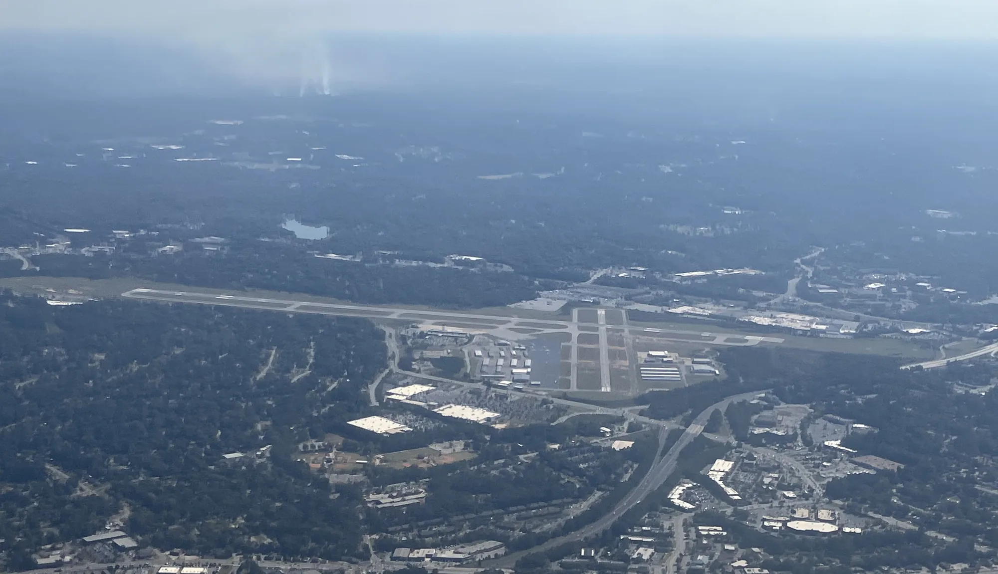
Northwest Columbus is the city’s biggest planning area: about 33,000 acres north of the old mill districts, from the Chattahoochee and Lake Oliver east past I-185 and Veterans Parkway. It holds the main shopping district around Columbus Park Crossing, Columbus Airport, the Old Town development and the Northside schools.
What this means for you
- Zoned high school: mostly Northside High (51% of sampled addresses), then Shaw (26%), Hardaway (17%) and Jordan Vocational (6%). Check yours with the district’s infoFinder lookup.
- Home value: $235,770 in ZIP 31909 in August 2026, according to the Zillow Home Value Index.
- Nearest interstate exit: I-185 Exit 10, US 80/J.R. Allen Parkway, about 1.7 miles by road from the middle of the area.
Part of our Columbus neighborhoods guide.
Where it is
This is the comprehensive plan’s Northwest Columbus planning area (Planning Area A). Veterans Parkway (US 27), Whittlesey Boulevard, Airport Thruway, Double Churches Road, River Road and J.R. Allen Parkway are the main roads. OpenStreetMap places Green Island Hills, Lake Oliver Estates, Moores Forest, Fortson Terrace, Nankipooh and Morningside here, among others.
The comprehensive plan says the northwest and the Panhandle grew fast in the 1990s and 2000s, then slowed after the 2008 recession and because of “issues with terrain in the northwest.” It says land north of the city is “primarily estate lots and commercial development” and that “development pressures will arise as the widening of US 27 nears completion.” It names two character areas here:
- Veterans-Whittlesey Commercial Corridor, taking in Columbus Park Crossing, Northlake, Calvary and Bradley Park, “the central retail destination in Columbus and the region.” The plan wants it reviewed for mixed-use redevelopment as stores empty, and lists intersection work at Bradley Park Drive and J.R. Allen Parkway.
- Old Town, a 300-acre mixed-use development with single-family homes, apartments, live-work units and lofts around a main street and a civic gathering area. The plan calls it “the first and only modern true mixed-use development in Columbus” and wants trails linking new building to the school district’s Northside campuses.
The city’s address data has 20,763 address points here, 18,725 of them residential. By ZIP code, 63% are in 31909, 31% in 31904, 5% in 31808 and 2% in 31820.
Schools
How a random sample of 160 residential address points here came back in the district’s infoFinder lookup on Oct. 6, 2026. Some addresses returned two schools at the same level, so shares can add to more than 100%. Scores are 2025 College and Career Ready Performance Index (CCRPI) figures from the state’s School Grades report.
| Level | School | Share of sampled addresses | 2025 CCRPI |
|---|---|---|---|
| High | Northside High (district report card) | 51% | 82.6 |
| High | Shaw High (report card) | 26% | 69.3 |
| High | Hardaway High (report card) | 17% | 64.0 |
| High | Jordan Vocational High (report card) | 6% | 63.0 |
| Middle | Veterans Memorial Middle (district report card) | 38% | 69.1 |
| Middle | Blackmon Road Middle (report card) | 28% | 78.0 |
| Middle | Double Churches Middle (report card) | 26% | 67.2 |
| Middle | Arnold Middle (report card) | 8% | 68.2 |
| Elementary | Double Churches Elementary (report card) | 24% | 61.0 |
| Elementary | North Columbus Elementary (report card) | 22% | 84.3 |
| Elementary | Blanchard Elementary (report card) | 19% | 86.0 |
| Elementary | Eagle Ridge Academy (report card) | 19% | 72.2 |
| Elementary | River Road Elementary (report card) | 9% | 58.2 |
| Elementary | Allen Elementary (report card) | 8% | 57.5 |
| Elementary | Britt David Magnet Academy (report card) | 8% | 98.8 |
A few addresses were zoned for Fort Middle, Midland Middle or Gentian Elementary. Northside High, 2002 American Way, and Shaw High, 7579 Raider Way, are both inside the area. The state average was 78.0 and the district scored 69.3. More in our Columbus schools guide.
Home values
From the Zillow Home Value Index for August 2026:
| ZIP code | Zillow’s place name | Share of addresses here | Typical value | Change in a year |
|---|---|---|---|---|
| 31909 | Columbus | 63% | $235,770 | +2.80% |
| 31904 | Columbus | 31% | $220,602 | +3.96% |
| 31808 | Fortson | 5% | $403,145 | +3.35% |
The index is a modeled typical value for the middle third of homes, not a sale price. ZIP 31808 is mostly in Harris County, so its figure says little about the Columbus side. The citywide figure was $175,951, up 2.92%. More in our home prices guide.
Parks and trails
From the city’s points of interest data and its parks pages:
- Lake Oliver Marina, 5501 River Road, at the north end of the RiverWalk, with a boat ramp.
- Britt David Park, 5560 Armour Road, and the Britt David Park Cultural Arts Studio, 2700 W. Britt David Road.
- Double Churches Park and Double Churches Pool, 2300 Double Churches Road.
- Northside Park, 2010 American Way.
- Heath Park, 5845 Datchet Lane.
- Columbus Botanical Garden, 3603 Weems Road, according to OpenStreetMap.
- Standing Boy Trails, dirt trails; see our walking and biking trails guide.
- North Columbus Public Library, 5689 Armour Road.
More in our parks and trails guide.
Getting around
- Interstate: I-185 Exit 10, US 80/J.R. Allen Parkway, about 1.7 miles by road; Exit 12, Williams Road, about 2.2 miles. The northern end of the area is near Exit 14, Smith Road.
- Government Center, 100 10th St.: about 7.4 miles.
- Columbus Airport: about 2.3 miles. Hartsfield-Jackson Atlanta International Airport: about 95.4 miles.
- Distances are measured on the OpenStreetMap road network with the OSRM routing engine from 2980 North Lake Parkway, an address near the middle of the area’s homes. They are distances, not drive times, and the area is large: addresses near the river or the county line are farther.
- Bus: in the city’s METRA stop data, stops here are mostly on Route 10, Airport Thruway/Veterans Parkway and Route 9, Bradley Park/Columbus Park Crossing. Much of the area has no stop.
More in our getting around guide.
Groceries and everyday stores
From OpenStreetMap:
- Publix, 1639 Bradley Park Drive; 7600 Schomburg Road; 8132 Veterans Parkway
- The Fresh Market, 1591 Bradley Park Drive
- ALDI, 6301 Veterans Parkway
- Walmart Supercenter, 5448 Whittlesey Blvd. and 2801 Airport Thruway
- CVS Pharmacy, 1367 Double Churches Road
- Walgreens, 7869 Veterans Parkway
The main retail center is the Columbus Park Crossing area on Whittlesey Boulevard.
How we drew this area
This area is the comprehensive plan’s Northwest Columbus planning area, taken from the Columbus Consolidated Government’s planning area map layer. Address counts and ZIP codes come from the city’s address point layer. School shares come from 160 randomly chosen residential address points checked against the district’s infoFinder lookup on Oct. 6, 2026. Store locations are © OpenStreetMap contributors.
Frequently asked questions
Is North Columbus a good place to live?
Here are the facts. Northwest Columbus is the city’s largest planning area, with Columbus Park Crossing, Old Town, Lake Oliver and Columbus Airport. About half of sampled addresses are zoned for Northside High, which scored 82.6 on Georgia’s 2025 CCRPI, and Zillow put the typical home value in ZIP 31909 at $235,770 in August 2026.
What high school is North Columbus zoned for?
Mostly Northside High. In the district’s lookup, 51% of sampled Northwest Columbus addresses were zoned for Northside, 26% for Shaw, 17% for Hardaway and 6% for Jordan Vocational.
What ZIP code is North Columbus, Georgia?
Mostly 31909 (63% of residential addresses in the planning area) and 31904 (31%), with smaller parts in 31808 and 31820, according to the city’s address data.
What is Old Town in Columbus, Georgia?
A 300-acre mixed-use development in the northwest with homes, apartments, live-work units, lofts and shops around a main street and a civic gathering area. The city’s comprehensive plan calls it the first modern true mixed-use development in Columbus.
Have your say