Southeast Columbus is 89% ZIP 31907, where Zillow's typical value was $162,219 in August 2026. Half of sampled addresses are zoned for Kendrick High.
Last checked Oct. 6, 2026. Sources: the city’s 2038 Comprehensive Plan, 2023 update (PDF), the city’s planning area, points of interest and address point map layers, the Muscogee County School District’s infoFinder zone lookup, the state’s 2025 School Grades data, Zillow Research, METRA and OpenStreetMap.
Southeast Columbus is the large area east of I-185, from Manchester Expressway and Columbus State University south along Buena Vista Road, Forrest Road and St. Marys Road toward Fort Benning. It is the comprehensive plan’s Southeast Columbus planning area (Planning Area E), about 18,000 acres, and it has more homes than any other planning area in the city’s address data.
What this means for you
- Zoned high school: mostly Kendrick High (51% of sampled addresses), then Hardaway (23%), Spencer (18%) and Carver (8%). Check yours with the district’s infoFinder lookup.
- Home value: $162,219 in ZIP 31907 in August 2026, according to the Zillow Home Value Index.
- Nearest interstate exit: I-185 Exit 4, Buena Vista Road, about 1.6 miles by road from the middle of the area.
Part of our Columbus neighborhoods guide.
Where it is
Macon Road, Buena Vista Road, St. Marys Road, Forrest Road, Milgen Road, Gentian Boulevard and Schatulga Road are the main roads. OpenStreetMap places Edgewood, Gentian, Georgetown, Wesley Heights, Dimon Woods, Forest Park, Crystal Valley and Schatulga here, among others.
The comprehensive plan says recent growth in Columbus has come in the northwest, the Panhandle and Southeast Columbus, and that land east of the city “is extensively developed, and further development is limited by physical constraints (Fort Benning).” It names two character areas here:
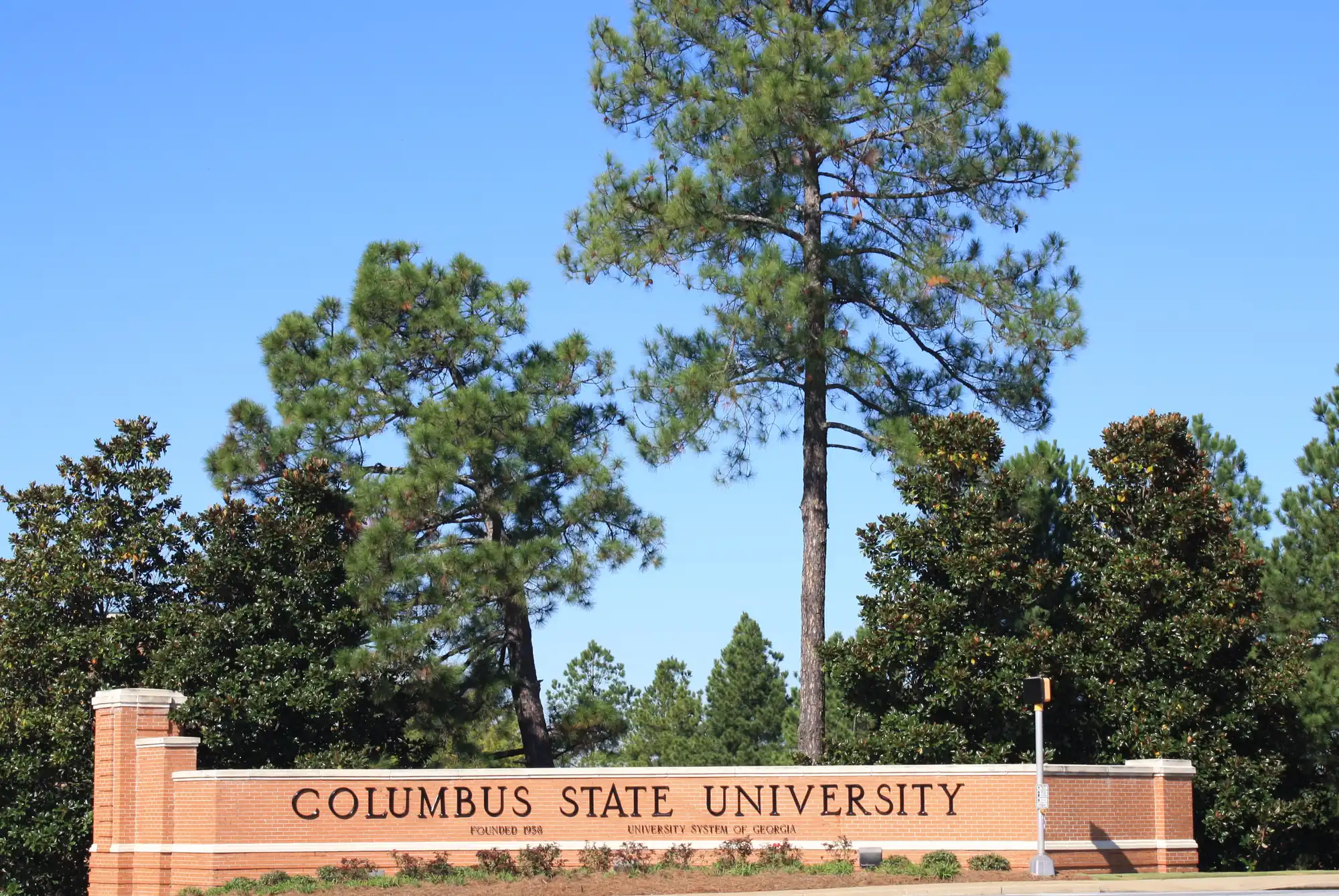
- Columbus State University, “the only four-year institution in the governor’s 17-county Economic Region 5.” The plan backs a University Avenue road diet, roundabouts on College Drive, apartments between Valley Drive and Anglin Drive, mixed use at University Avenue and Gentian Boulevard, and better sidewalks around the campus.
- Cooper Creek Park, where the plan expects the expanded tennis center and the Fall Line Trace to help turn a warehouse and light-industrial area into mixed-use development, with intersection work along Gentian Boulevard and Milgen Road.
The city’s address data has 23,730 address points here, 21,936 of them residential. By ZIP code, 89% are in 31907, 8% in 31906 and 3% in 31903.
Schools
How a random sample of 160 residential address points here came back in the district’s infoFinder lookup on Oct. 6, 2026. Some addresses returned two schools at the same level, so shares can add to more than 100%. Scores are 2025 College and Career Ready Performance Index (CCRPI) figures from the state’s School Grades report.
| Level | School | Share of sampled addresses | 2025 CCRPI |
|---|---|---|---|
| High | Kendrick High (report card) | 51% | 63.0 |
| High | Hardaway High (report card) | 23% | 64.0 |
| High | Spencer High (report card) | 18% | 63.9 |
| High | Carver High (district report card) | 8% | 68.7 |
| Middle | Fort Middle (report card) | 28% | 62.8 |
| Middle | Rothschild Leadership Academy (report card) | 25% | 57.0 |
| Middle | East Columbus Magnet Academy (report card) | 25% | 63.3 |
| Middle | Baker Middle (report card) | 11% | 56.4 |
| Elementary | Mary A. Buckner Academy (report card) | 23% | 56.5 |
| Elementary | Wesley Heights Elementary (report card) | 15% | 61.2 |
| Elementary | Georgetown Elementary (report card) | 10% | 53.6 |
| Elementary | Forrest Road Elementary (report card) | 9% | 53.4 |
| Elementary | Dimon Elementary (report card) | 9% | 54.8 |
| Elementary | Dorothy Height Elementary (report card) | 9% | 45.8 |
| Elementary | Reese Road Leadership Academy (report card) | 8% | 74.7 |
| Elementary | Gentian Elementary (report card) | 7% | 59.6 |
| Elementary | Lonnie Jackson Academy (report card) | 6% | 72.3 |
The lookup also returned Edgewood Elementary for 9% of sampled addresses and St. Marys Elementary for 6%; neither has a 2025 score under those names in the state’s data. Smaller shares went to Richards, Midland, Eddy and Aaron Cohn middle schools and to five other elementary schools. Kendrick High, 6015 Georgetown Drive, is inside the area. The state average was 78.0 and the district scored 69.3. More in our Columbus schools guide.
Home values
From the Zillow Home Value Index for August 2026:
| ZIP code | Share of addresses here | Typical value | Change in a year |
|---|---|---|---|
| 31907 | 89% | $162,219 | +3.61% |
| 31906 | 8% | $132,375 | -0.35% |
| 31903 | 3% | $71,776 | +2.82% |
The index is a modeled typical value for the middle third of homes, not a sale price. ZIP 31907 also reaches into the Panhandle. The citywide figure was $175,951, up 2.92% on the year. More in our home prices guide.
Parks and trails
From the city’s points of interest data and its parks pages:
- Cooper Creek Park, 4816 Milgen Road, with the tennis center.
- Carver Park and recreation center, 6665 Hunter Road, with a free splash pad in summer.
- Edgewood Park and Edgewood Pool, 1425 and 1429 Morris Road.
- Shirley Winston Park and pool, 5025 Steam Mill Road.
- Woodruff Farm Soccer Complex, 3151 Woodruff Farm Road.
- Primus King Park, 1421 Staunton Drive; Belvedere Park, 726 Parkwood Drive; Crystal Valley Park, 6250 Crystal Drive.
- Fall Line Trace: the paved rail-trail’s middle miles, about mile 4 to mile 7, follow Gentian Boulevard and Milgen Road through the area, by the city’s mile markers.
More in our parks and trails guide and walking and biking trails guide.
Getting around
- Interstate: I-185 Exit 4, Buena Vista Road, about 1.6 miles by road; Exit 3, St. Marys Road, about 2.5 miles; Exit 6, Macon Road, about 2.8 miles.
- Government Center, 100 10th St.: about 6.7 miles.
- Columbus Airport: about 6.5 miles. Hartsfield-Jackson Atlanta International Airport: about 101.8 miles.
- Distances are measured on the OpenStreetMap road network with the OSRM routing engine from 1201 Bismarck Drive, an address near the middle of the area’s homes. They are distances, not drive times.
- Bus: in the city’s METRA stop data, most stops here are on Route 3, St. Mary’s Road/Buena Vista Road/Schatulga Road, with more on Route 7, Route 6 and Route 5.
More in our getting around guide.
Groceries and everyday stores
From OpenStreetMap:
- Publix, 5435 Woodruff Farm Road
- Walmart Neighborhood Market, 4909 Buena Vista Road
OpenStreetMap also places Walgreens pharmacies on Buena Vista Road and near Macon Road and Box Road.
How we drew this area
This area is the comprehensive plan’s Southeast Columbus planning area, taken from the Columbus Consolidated Government’s planning area map layer. Address counts and ZIP codes come from the city’s address point layer. School shares come from 160 randomly chosen residential address points checked against the district’s infoFinder lookup on Oct. 6, 2026. Store locations are © OpenStreetMap contributors.
Frequently asked questions
Is Southeast Columbus a good place to live?
Here are the facts. Southeast Columbus is the planning area with the most homes in the city’s address data, east of I-185, with Columbus State University, Cooper Creek Park and the Fall Line Trace. In a sample of addresses, 51% were zoned for Kendrick High, which scored 63.0 on Georgia’s 2025 CCRPI, and Zillow put the typical value in ZIP 31907 at $162,219 in August 2026.
What high school serves Southeast Columbus?
Mostly Kendrick High. In the district’s lookup, 51% of sampled addresses were zoned for Kendrick, 23% for Hardaway, 18% for Spencer and 8% for Carver.
What ZIP code is Southeast Columbus?
Mostly 31907, which covers 89% of residential addresses in the planning area, with smaller parts in 31906 and 31903, according to the city’s address data.
Where is Columbus State University’s main campus?
In Southeast Columbus, on University Avenue near Gentian Boulevard. The city’s comprehensive plan treats the campus and the streets around it as their own character area.
Have your say